Old Images of the Forth Bridge at Queensferry

 Enjoy a glimpse of history through old images of the Forth Rail Bridge at Queensferry, Scotland.


In the distant past, Queensferry had the Gaelic name of Taobh a Deas Chas Chaolais or Chas Chaolais, meaning the Steep Strait, clearly taken directly from the geography of the area. The English name refers instead to a vital transport system established here a thousand years ago.

Before the building of the bridges across the Firth of Forth, all traffic had to either take a lengthy detour round the waters, or cross by ferry.

Tradition says that Saint Margaret of Scotland established a ferry here for the pilgrims heading north to St Andrews. Indeed, after her death in 1093, the ferry was used to transport her body on its journey to Dunfermline Abbey. Then the ferry rights were awarded to the abbey by her son, David I of Scotland.

The Forth Bridge is a cantilever bridge. Its construction began in 1882, and it was opened to rail traffic on 4th March 1890.

In 1964, the nearby Forth Road Bridge opened, allowing road traffic to cross the Firth of Forth.

Because of the second bridge, the Forth Bridge is often now referred to as the Forth Rail Bridge, although that was never its official name.


Construction of the Forth Rail Bridge

The archives at the National Library of Scotland hold several important visual records showing the construction of this world famous bridge in the 1880s.

The first is an artist's impression of the bridge yet to be started, imposing a drawing onto a photograph of the Firth of Forth. This is a full century before the invention of Photoshop!
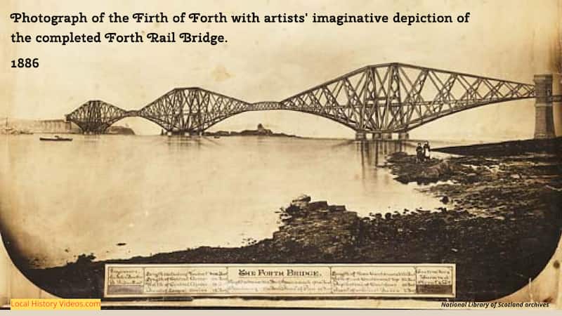
Artist impression of the Forth Rail Bridge 1886
An artist impression of the Forth Rail Bridge before it was built, using a photograph of the Firth of Forth

Next we see the early stages of construction underway.
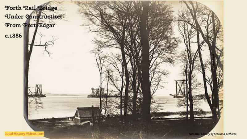
Old photo of the Forth Rail Bridge under construction
Old photo of the Forth Rail Bridge under construction, taken from Port Edgar sometime around 1886
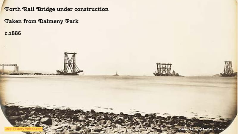
old photo of Forth Rail Bridge Fife from Dalmeny Park 1886
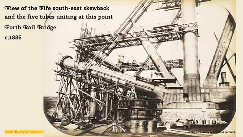
old photo of Forth Rail Bridge Fife southeast skewback 1886
Old photo of the Forth Rail Bridge in Fife under constructin, showing the southeast skewback in around 1886

We're now so used to this iconic bridge, it can be hard to imagine how its enormous scale and towering height must have awed and amazed local residents and curious visitors.
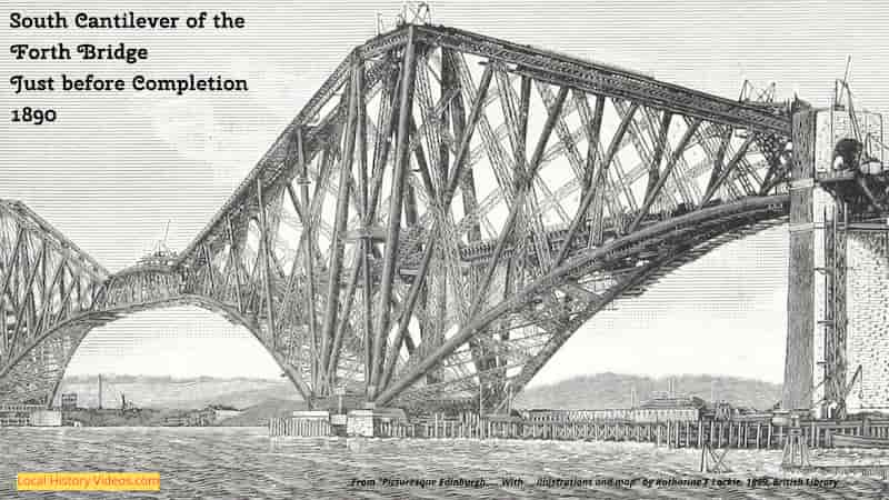
old picture of the Forth Rail Bridge 1890
Book illustration of the South Cantilever of the Forth Rail Bridge just before completion in 1890
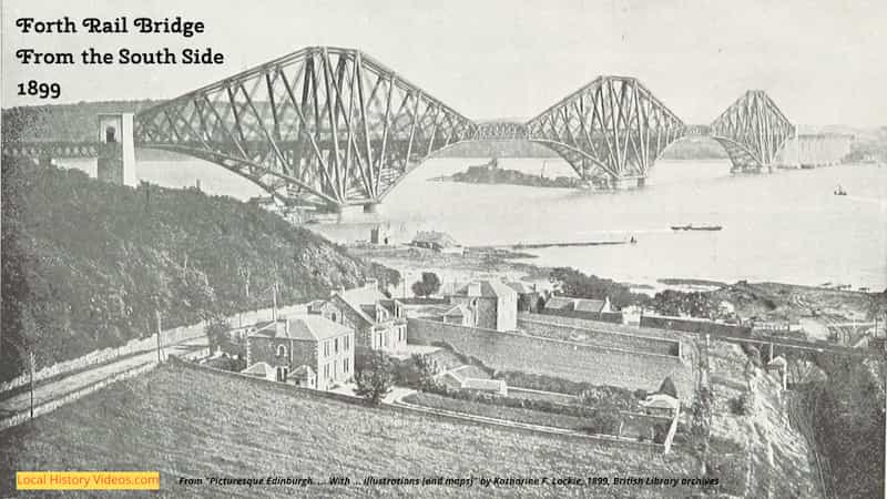
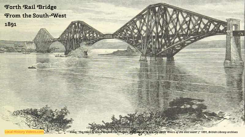
Old picture of the Forth Rail Bridge
Old picture of the Forth Rail Bridge, taken from the south west side in 1891
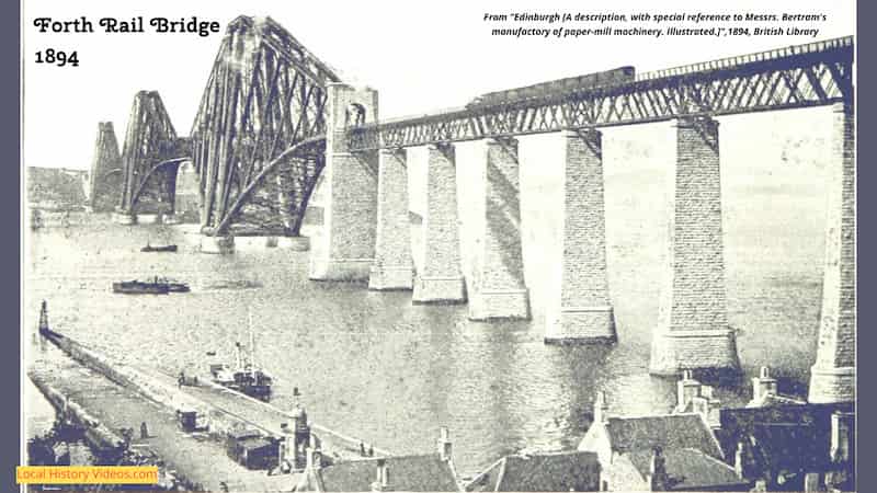
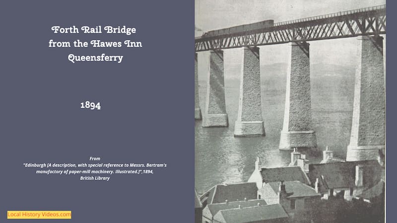
old photo of the Forth Rail Bridge 1894
Old photo of the Forth Rail Bridge, taken from Queensferry's Hawes Inn, 1894
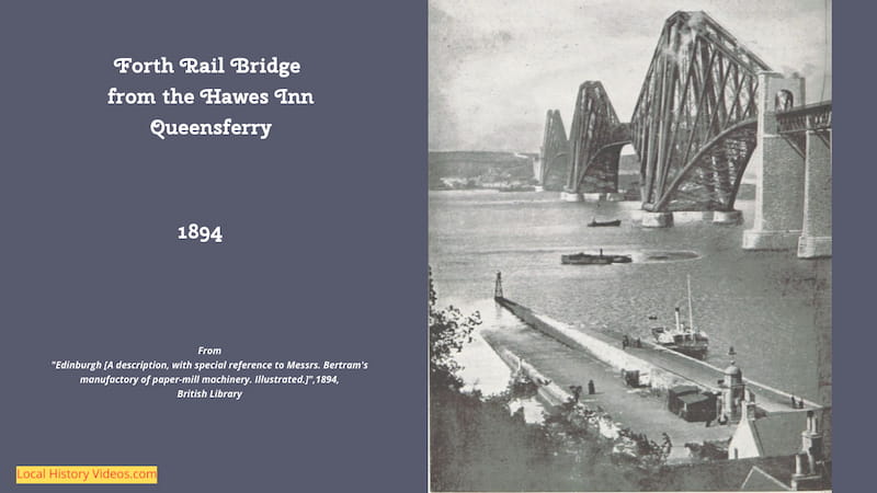
Old photo of the Forth Rail Bridge
Old photo of the Forth Rail Bridge, taken from Queensferry's Hawes Inn, 1894
From Hawes Inn Queenserry Forth Rail Bridge 1894
Old photo of the Forth Rail Bridge
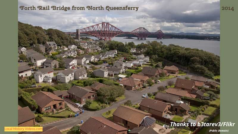
Forth Rail Bridge 2014
Photograph of the Forth Rail Bridge in 2014, taken from North Queensferry

The Forth Bridge Through Time

Enioy a video from YouTube channel The Time Travel Artist. James used old images to transform the Firth of Forth through time.


The Forth Bridge: A Journey through time.  The Time Travel Artist (YouTub

Comments

Popular posts from this blog

Old Images of Spokane, Washington: Vintage Photos and Archive Film

Glimpse history through old images of  Spokane , Washington. Spokane  in 1902 Panorama of Spokane, Washington, taken sometime around 1902. With thanks to the Library of Congress Prints and Photographs Division. Closeup of two extracts from the panorama of Spokane, Washington, taken sometime around 1902. With thanks to the Library of Congress Prints and Photographs Division. Closeup of two extracts from the panorama of  Spokane , Washington, taken sometime around 1902. With thanks to the Library of Congress Prints and Photographs Division. Spokane ’s Davenport Restaurant Spokane ’s Davenport Restaurant was an internationally renowned venue which offered popular Sunday afternoon tea dances. Old photo of the Davenport Restaurant in Spokane, Washington, taken around 1908. With thanks to the Library of Congress Prints and Photographs Division. Closeup of an extract of the old photo of the Davenport Restaurant in  Spokane , Washington, taken around 1908. With thanks to the...

The History of Manchester, New Hampshire and the Amoskeag Manufacturing Company

  The story of Manchester, New Hampshire, is the definitive narrative of the American Industrial Revolution. It is a chronicle that spans centuries, transforming a vital Indigenous fishing ground into a planned corporate utopia that housed the world's largest textile empire, before navigating a devastating collapse and emerging as a modern high-tech hub. At the absolute center of this transformation was the Merrimack River, the Amoskeag Falls, and a corporate behemoth known as the Amoskeag Manufacturing Company. Manchester, New Hampshire, composed from sketches taken near Rock Raymond by J.B. Bachelder, 1855. 1. Ancient Waters and Colonial Beginnings (Pre-1810) Long before brick mills lined the Merrimack River, the geography of modern-day Manchester was shaped by the Amoskeag Falls . Dropping approximately 55 feet over a short distance, the roaring rapids created a massive natural barrier for migrating fish—and an invaluable resource for human inhabitants. Walking along the street ...

10 Historical Facts That Shaped North Conway, New Hampshire

  Nestled dramatically beneath the sheer granite cliffs of Cathedral Ledge in Carroll County, North Conway, New Hampshire , is famous as a premier gateway to the White Mountains. Unlike a standalone municipality, North Conway is a distinct major village legally contained within the broader township of Conway. Its evolution from a fertile Abenaki riverfront valley into a haven for 19th-century fine artists and a pioneer of American winter sports represents one of the most successful resort transitions in New England. Old photo of the skimobile up Cranmore Mountain, North Conway, NH - circa 1940   Part of the Original 1765 Royal Charter: North Conway’s municipal history began on October 1, 1765 , when colonial Governor Benning Wentworth issued a formal royal charter establishing the township of Conway. Named directly to honor Henry Seymour Conway—a prominent British statesman and military commander who championed colonial interests in Parliament—the grant required early pioneer...